A Collections Chronicles Blog
by Martina Caruso, Director of Collections
August 20, 2020
The South Street Seaport Museum recently acquired a series of aerial photographs by Fairchild Aerial Surveys, Inc. that assists the Museum celebrating the greatness of the New York natural harbor, and the development of the Port of New York as primary commercial and passenger gate to America.
The collection consists of almost 300 black and white aerial photographs taken by Fairchild Aerial Surveys in the first half of the 20th century, stretching from 1925 up until 1960. The bulk of the collection covers ships in and around New York Harbor, including barges, lightships, tankers, ferries, tugboats, floating drydocks, magnificent ocean liners, and Hudson River excursion vessels, although other subjects and locales can be found in the collection as well.
But before I go into the details of the Fairchild Aerial Surveys Inc. firm, its founder, and a selection of these incredible photographs, let me talk briefly about the immense technological advancements that aerial photography brought, and keeps bringing to the world.
The Basics of Aerial Photography
Apparently, it wasn’t long after commercial photography was invented in the mid-19th century before “adventurous amateurs” launched cameras into the sky using balloons, kites, and even rockets[1]According to Paula Amad’s overview of the history of aerial photography “From God’s-eye to Camera-eye: Aerial Photography’s Post-humanist and Neo-humanist Visions of the World” , … Continue reading. The first aerial photograph was captured in 1858 by Gaspar Felix Tournachon, more commonly known as “Nadar,” roughly three decades after his first successful photograph. Though these original photos have been lost, Nadar retains credit for the first aerial photographs, marking 1858 as the official “anniversary date” for aerial photography.
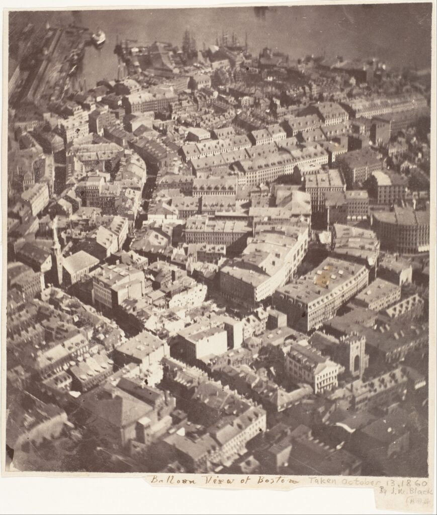
The first aerial images in the United States were taken two years later (seen here), by photographer James Wallace Black on October 13, 1860 from a hot-air balloon above Boston.
Only one image was successful, and is the oldest surviving aerial photograph, preserved in the collection of The Metropolitan Museum of Art.
James Wallace Black (American, Francestown, New Hampshire 1825–1896 Cambridge, Massachusetts), “Boston, as the Eagle and the Wild Goose See It” 1860. Albumen silver print from glass negative. Gilman Collection, Purchase, Ann Tenenbaum and Thomas H. Lee Gift, 2005. The Metropolitan Museum of Art 2005.100.87.
By 1909, photography was combined with the airplane, and during World War I, aerial photography replaced sketching and drawing by aerial observers.
During the 20th century, as photographic technology advanced, aerial photography quickly became a tool for a wide range of intelligence efforts, assessments of natural and man-made events, and geographic exploration.
For example, aerial reconnaissance of the German defenses in the Normandy region became a critical factor in Allied planning for the invasion and liberation of Nazi-occupied Europe in World War II. The dramatic sets of aerial photographs taken in the days before the Allied landings on June 6, 1944, are considered a revolutionary moment in how wars are fought. These photos were taken at high risk for the pilots, since the view is at relatively low altitude to be able to gain vital information and record on the enemy fortifications on the Normandy beaches[2] “Photography Changes How War are Fought” by Von Hardesty. Published in “Photography Changes Everything”, Aperture Foundation and Smithsonian Institution, 2012, pp. 195-197..
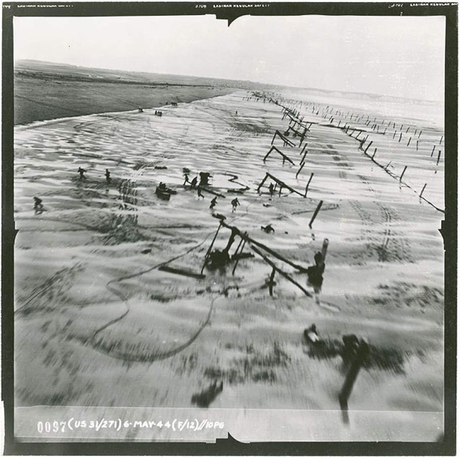
Left: 31st Photo Reconnaissance Squadron, May 6, 1944. National Air and Space Museum Archives, Smithsonian Institution, 9A05352A.
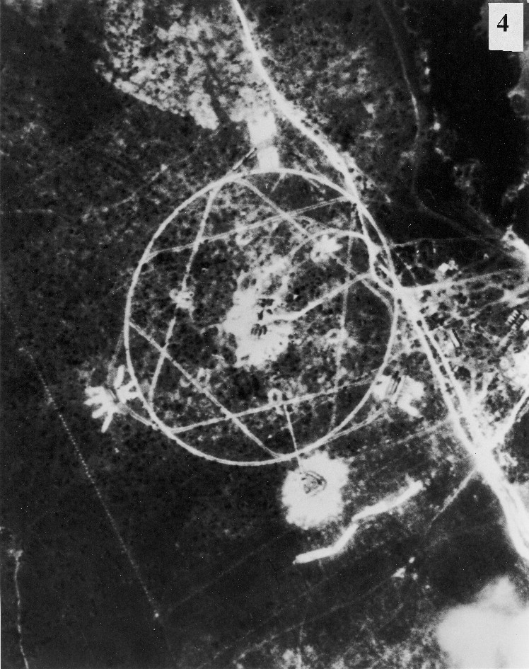
Right: U-2 photograph of SA-2 surface-to-air missile (SAM) site under construction at La Coloma, Cuba, 1962. The National Security Archive, The George Washington University.
Aerial photography also changed the development of major international events, like the views of missile sites under construction in Cuba in 1962 as part of the Cuban Missile Crisis (see above.)[3]“Photography Changes the Course of International Events” by Sandra S. Phillips. Published in “Photography Changes Everything”, Aperture Foundation and Smithsonian Institution, … Continue reading and more recently, aerial photography documentation is able to aid archaeologists in a wide variety of projects tied to land use, planning, and discovery.
Sherman M. Fairchild and Fairchild Aerial Surveys, Inc.
Fairchild Aerial Surveys, Inc. was founded by American businessman, investor, and inventor Sherman Mills Fairchild (1896 – 1971) in the years following World War I.
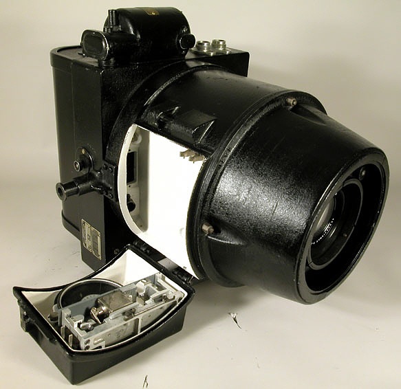
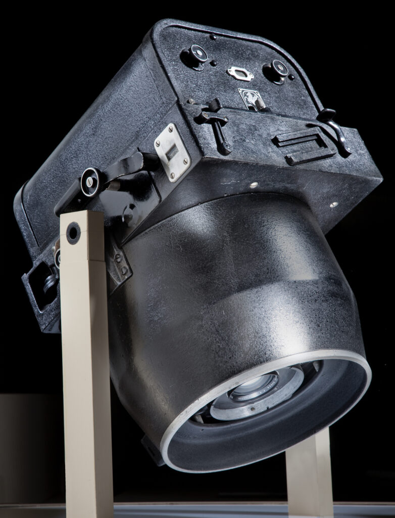
Mr. Fairchild was denied military entry as a pilot during the first World War, but he was determined to help the war effort, and honed his energy to develop an advanced aerial camera. In 1919, he designed a revolutionary new high-quality aerial camera called K-3. It was electrically driven, featuring between-the-lens shutter, detachable magazine, and other innovations which advanced the technology of aerial photography in radical ways, setting the technical standard for commercial and military mapping and for vertical and oblique photography in the 1920s and ’30s.
By 1924 aerial photography and aerial maps had become enough of a business that Mr. Fairchild had to incorporate the company. Fairchild Aerial Surveys, Inc. had become very active in introducing the use of aerial photography for city planning, tax appraisal work, transmission line location, and many similar and allied subjects. A year later he also incorporated two small firms based in Los Angeles, the Pioneer Aerial Engineering Company and The Photomap Company, into Fairchild Aerial Surveys Inc.![4] THE STORY OF FAIRCHILD AERIAL SURVEYS, INC. by Leon T. Eliel, published on PHOTOGRAMMETRIC ENGINEERING JOURNAL, September 1942, pp. 163-170.
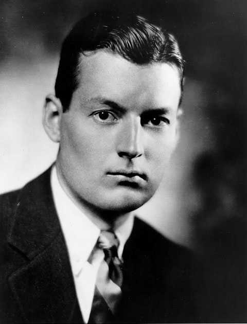
Left: “Sherman M. Fairchild” Sherman Fairchild Collection, Smithsonian National Air and Space Museum, Smithsonian Institution.
Center: Camera, Aerial, Fairchild K-3A , U.S.Navy. National Air and Space Museum Collection, Smithsonian Institution, A19710957000.
Right: Camera, Fairchild K-3B. National Air and Space Museum Collection, Smithsonian Institution, A19710955000.
By the 1940s Fairchild won a government contract for his cameras, and by World War II, 90% of the flight-equipped cameras were of Fairchild design.
After the war Fairchild turned his attention back to States’ commissions of aerial surveys and publicity shoots, and these photographs became easily commercially popular. The company expanded, manufacturing aircraft and even Lunar Mappers for NASA to capture images of the moon. The company went out of business in 1965, and today photographs from Fairchild Aerial Surveys Inc. can be found in the collections of many museums, libraries, archives, and state and federal agencies.
Highlights of the recently acquired photographs
West Side Piers
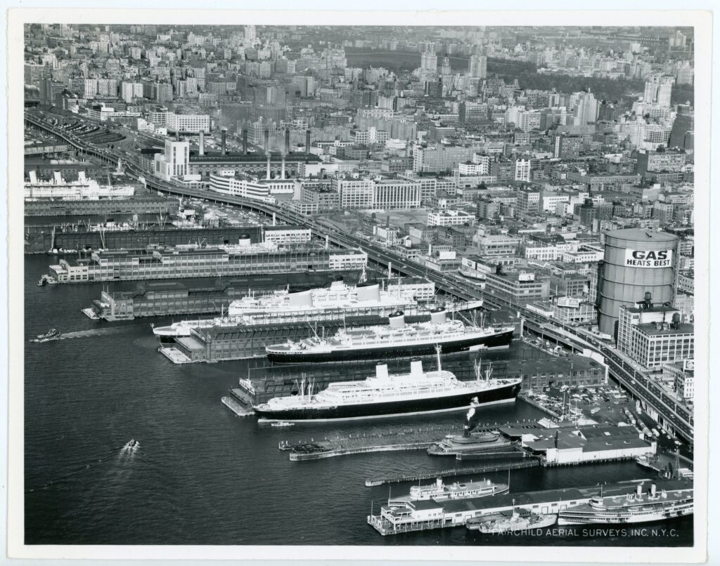
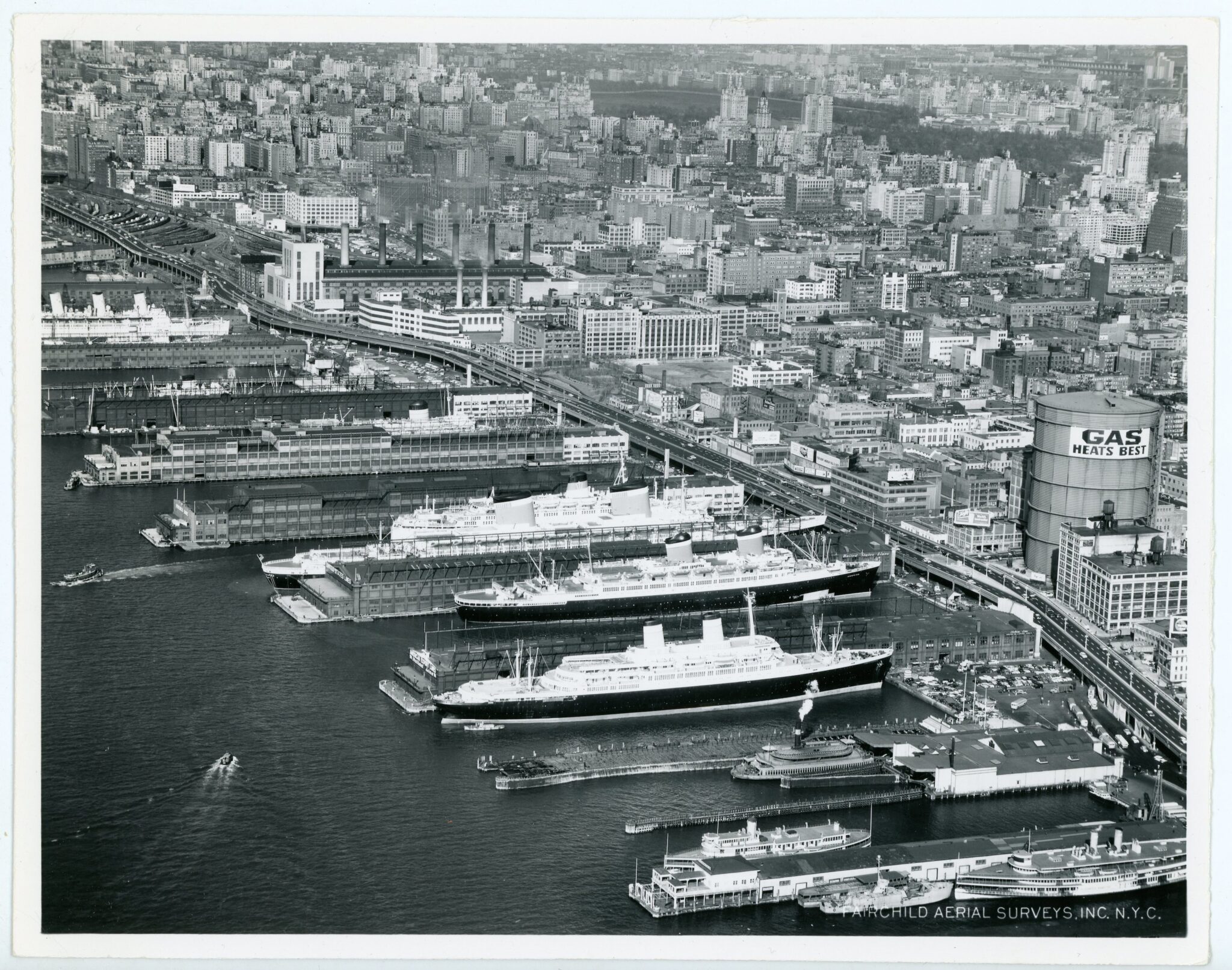
This photograph of Manhattan’s busy West Side piers was taken in March of 1957. Though there is a lot captured in this image (like the old IRT Powerhouse and a massive gas tank at 45th street), the row of ocean liners steals the show.
The area was called by many Manhattan’s Luxury Liner Row, and it was in a way a New York City landmark.[5] “Manhattan’s Luxury Liner Row” by William H. Miller, published on Power Ships, Spring 2020, pp. 10-15.
By the late 1950s most of these piers were used by double tenants.
“Mid-Town Piers” March 13, 1957. 2018.008.0025
Pier 84, built in 1918, was used by American Exports and the Italian lines. Pier 86, built in 1926, was leased to United States Lines. Pier 88, built in 1935, was used by French Line, Greek Line, North German Lloyd; and Pier 90-92, built in 1936-37, were Cunard-White Star Line. At the top end, Pier 95-97, built in the 1890s, were shared between Furness-Bermuda Line, Home Lines, Swedish-American Line, Hamburg-Atlantic Line, National Hellenic Line, and in the winter Canadian Pacific.
And the piers were thoughtfully numbered for the benefit of passengers, visitors, crew members, and vendors, so that by subtracting the number 40, one had their street address. For example, Pier 84 was located at West 44th Street.
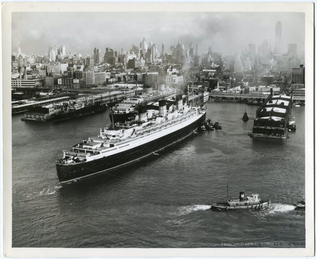
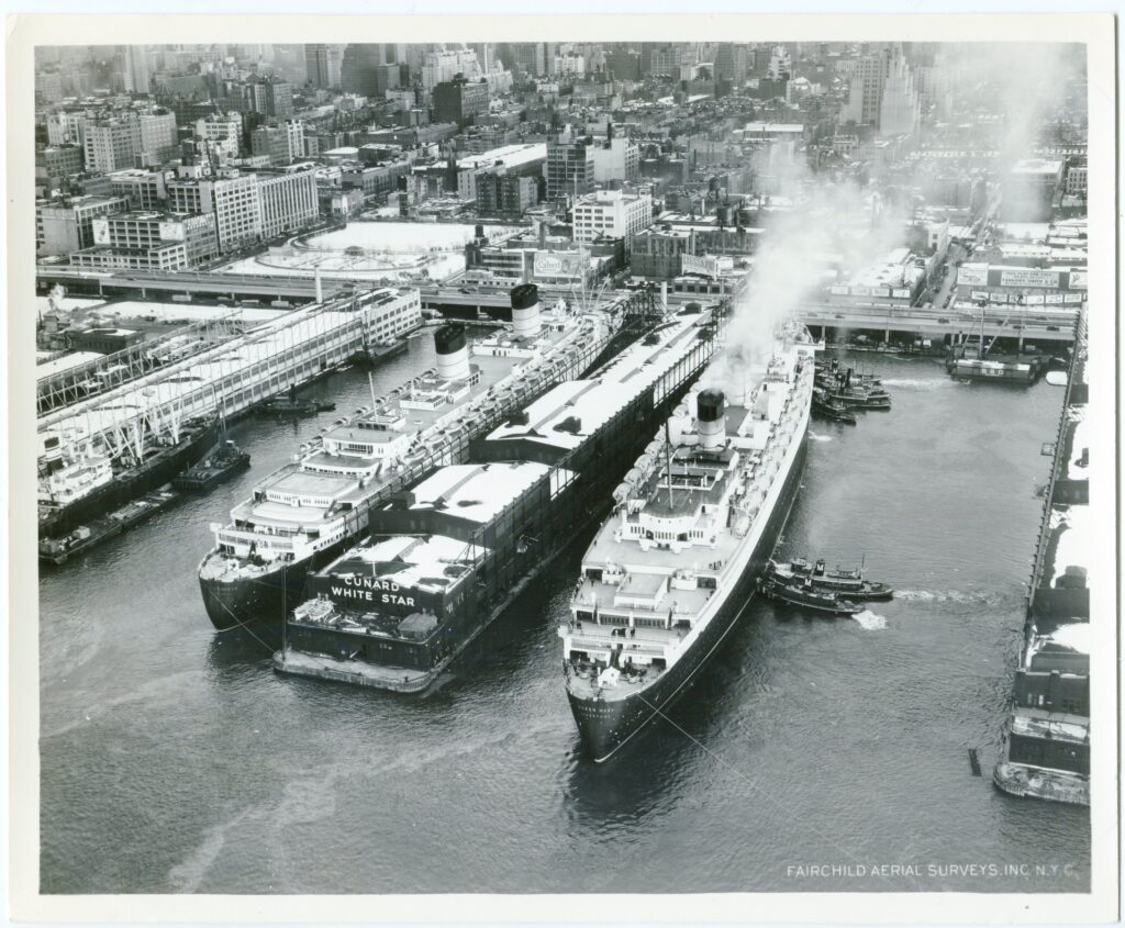
Left: [RMS Queen Mary] December 22, 1948. 2018.008.0020
Right: [RMS Queen Mary] December 22, 1948. 2018.008.0019
The Reserve Fleet
Who was keeping all of these ships ”in storage”?
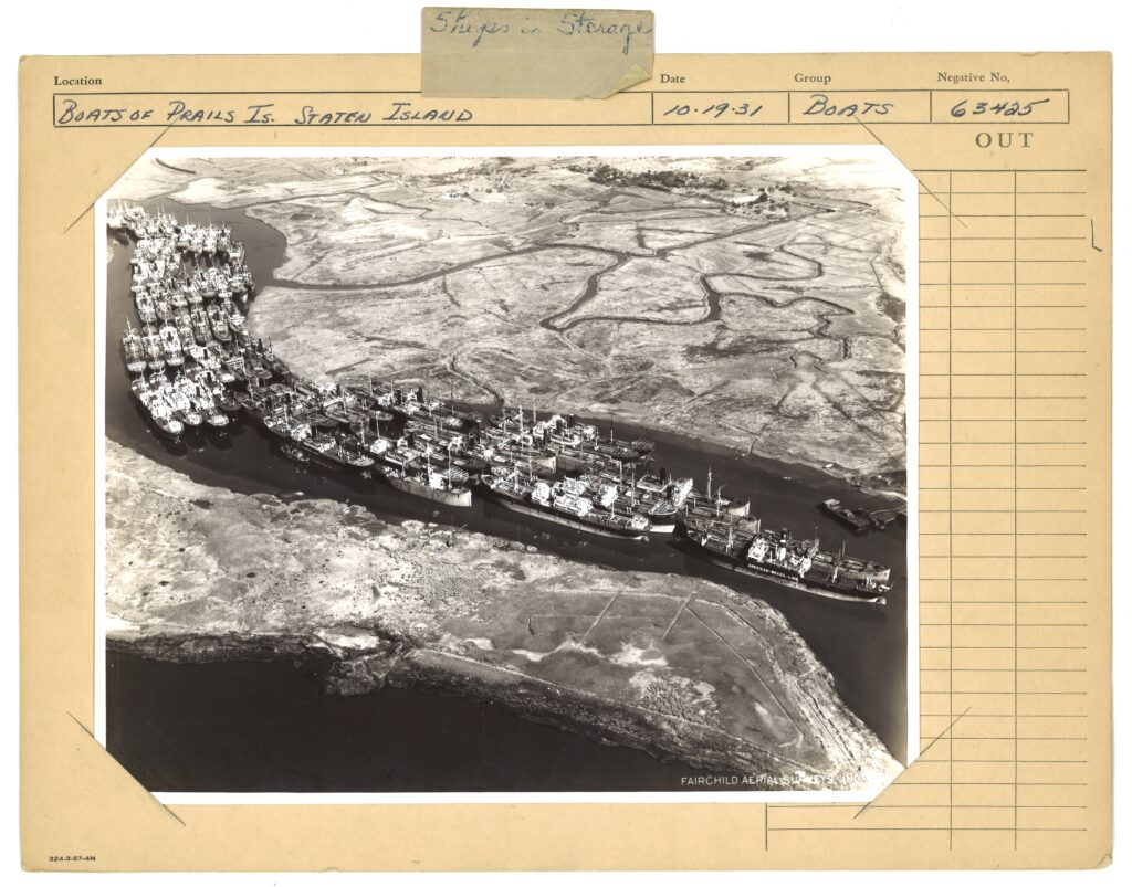
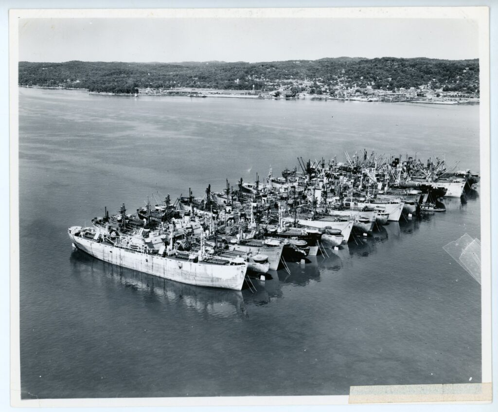
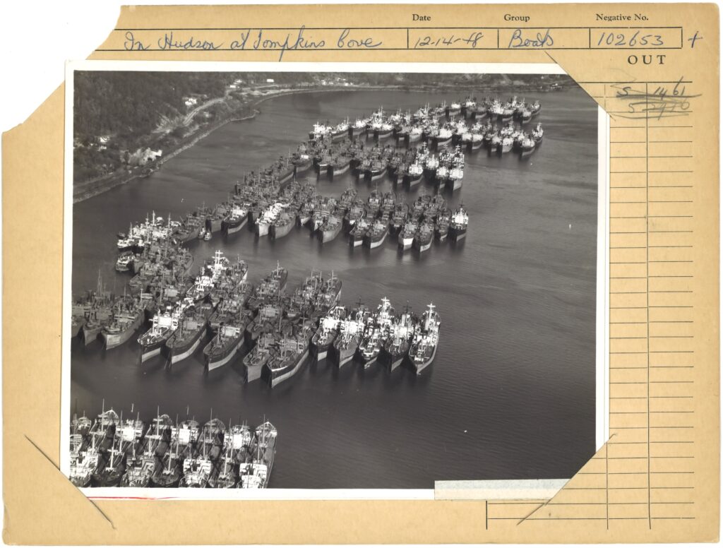
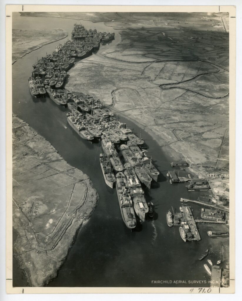
Left: [The Staten Island Reserve Fleet at Prall’s Island, Staten Island, New York] October 19, 1931. 2018.008.0155
Center: [The Hudson River National Defense Reserve Fleet off Tarrytown, New York] June 10, 1946. 2018.008.0167
Right: [The Hudson River National Defense Reserve Fleet at anchor in Tomkins Cove] December 14, 1948. 2018.008.0033
The Reserve Fleet was owned by the United States Shipping Board (USSB) which had been formed by the Merchant Marine Act of 1916. The Act was designed to secure an American merchant marine, in both peace and times of war, to protect commerce and support national defense.
Among other directives the Shipping Board could construct ships (preferably in American shipyards), charter ships, as well as lease and sell ships to American companies.
Both the Hudson Valley and the Staten Island Reserve Fleet were two of several “storage” fleets for Shipping Board vessels across the nation.
These photographs depict fleets of ships “in storage” in the Kill Van Kull, off Prall’s Island, Staten Island, and along the Hudson River, and are most likely the reason why we decided to acquire this collection. The Collection Committee members were struck by the beauty and the outstanding story of these shots.
[The Staten Island Reserve Fleet in the Arthur Kill, Staten Island, New York] July 38, 1937. 2018.008.0225
The Tugboat Strike of 1946
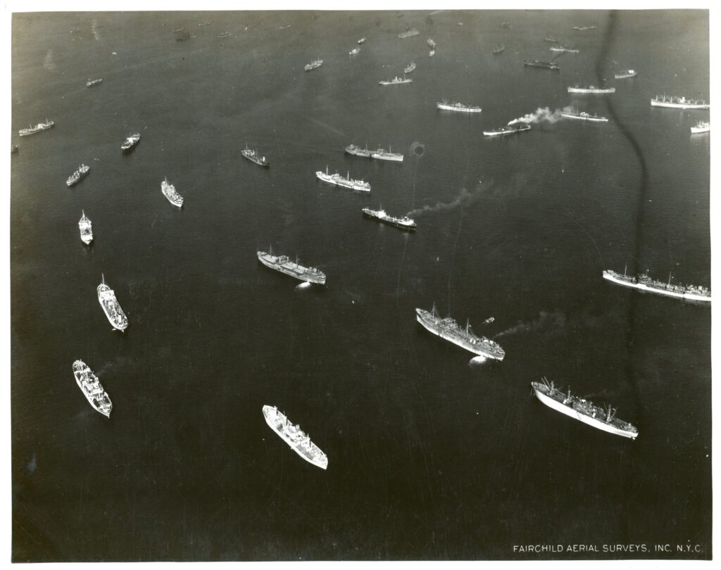
In February of 1946 dozens of ships sat idly in New York Harbor during a strike of the city’s 3,500 tugboat workers.
This strike lasted less than two weeks but effectively closed one of the world’s busiest ports and “shut down” New York City.
During World War II, in order to shift the entire economy to wartime production, workers and unions across industries promised to avoid striking as a bargaining tactic. When this agreement was lifted at the end of the war a wave of strikes broke out across the United States.
[Ships anchored in New York Harbor] February 12, 1946. 2018.008.0116
In New York, the tug operators union representatives wanted a 40-hour week (as opposed to a 48-hour week) and wage increases. Since the majority of New York City’s coal and fuel oil couldn’t be transported without tugs, Mayor Dwyer announced city-wide fuel rationing and the closing of public schools. The strike ended on February 13 with an agreement between tug workers and owners for further wage negotiation.
Building a Bridge
These images show tugboats towing pieces of the Tappan Zee bridge, recently rebuilt and renamed Governor Mario M. Cuomo bridge.
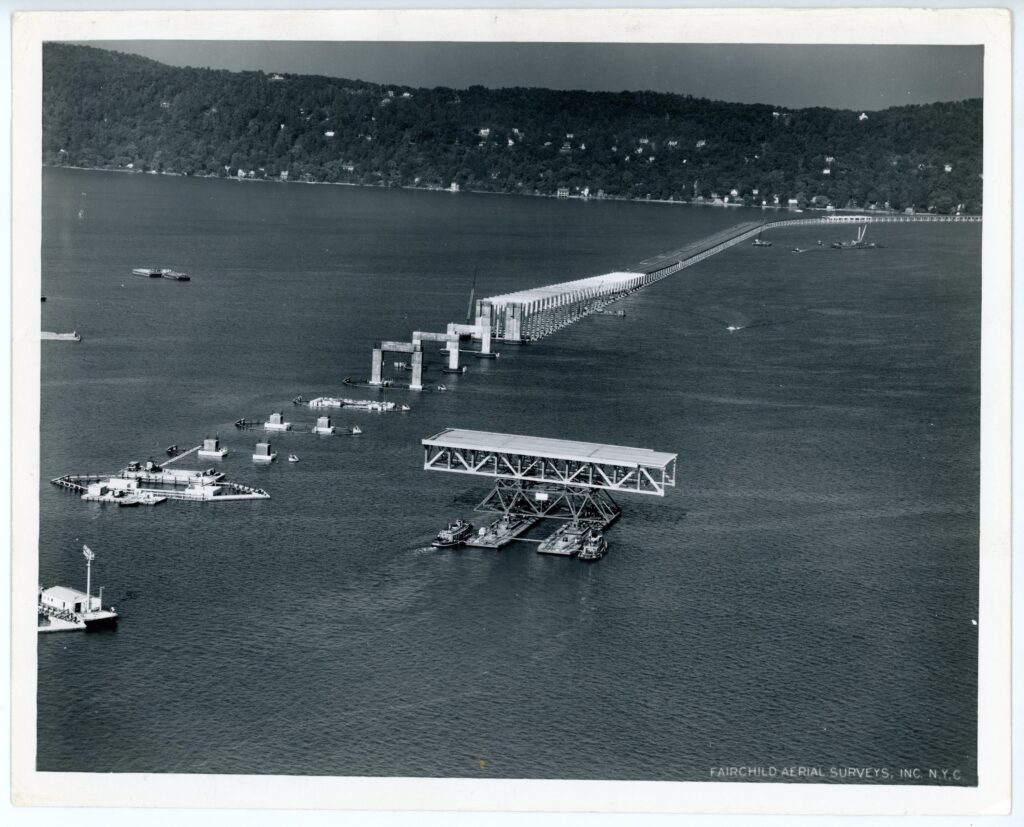
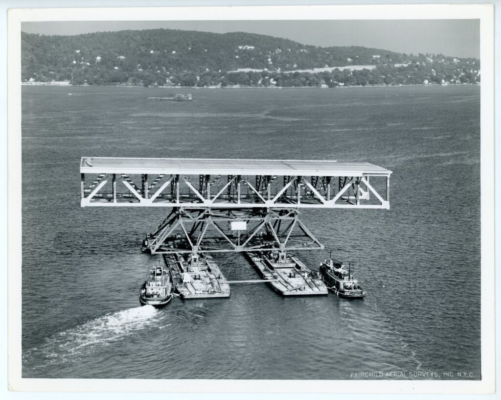
Left: “Thruway Bridge at Tarrytown, New York” July 30, 1954. 2018.008.0163
Right: “Tugboats Towing Bridge Sections at Tarrytown, New York” July 30, 1954. 2018.008.0164
Plans to connect Rockland and Westchester Counties started in the 1920s, but moved forward after World War II, in 1950, when the New York State Thruway Authority (NYSTA) was established to oversee the construction of a major highway connecting New York State, and a crossing of the Hudson was a necessary element of the highway’s continued expansion.
Work on the bridge began in March 1952 and in December 1955, the bridge was completed and opened to the public. The bridge 20 deck truss were constructed at an on-land yard facility and floated into place.
Mayflower II in New York City
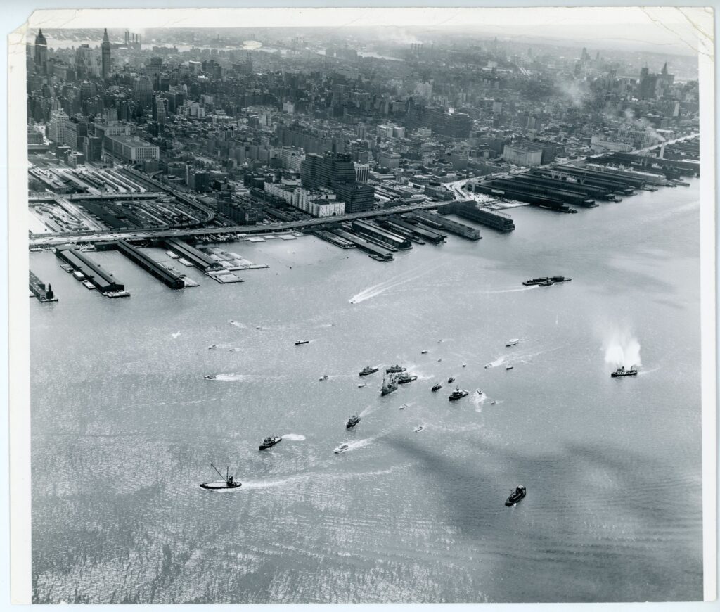
In this aerial photograph, dated May 1, 1957 you can see Mayflower II, a replica of the 17th-century ship Mayflower, entering the port of New York with a parade of other vessels.
Mayflower II was built in Devon, England, by English shipbuilders’ using traditional methods. On April 20, 1957 she began the solitary voyage across the Atlantic under the command of Alan Villiers.
To avoid the risk of winter ice, the new ship took a more southerly route than the original Mayflower in September 1620, but otherwise the voyage was an accurate replication of a period ocean crossing.
“Reception for Mayflower II in New York” July 1, 1957. 2018.008.0127
The weather cooperated; Mayflower II first sailed calm seas and then met a violent storm off Bermuda, common weather for a transatlantic crossing. On July 1, 1957 the Mayflower II arrived in New York City, and upon arrival, Captain and crew received a ticker-tape parade in New York City.
Abstracts Views
Lastly, some strangely beautiful shots. Their subjects appear to be scratches in the water, almost like drawings, but they all have meaningful stories to tell.
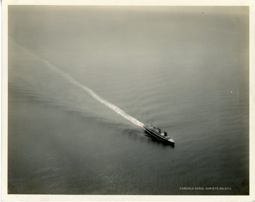
This aerial photograph depicts French Liner SS Normandie on June 3, 1935, approaching the United States and New York.
This photograph is particularly interesting because it is the liner’s first arrival in New York. SS Normandie left Le Harve on its maiden voyage on May 29th, 1935 and arrived in New York on June 3, 1935.
SS Normandie was launched by the French Line in 1935 to be the epitome of luxury on the Atlantic. Her exterior was streamlined while her interior was furnished by designers and artists including Jean Dupas, Lalique, and Luc Lanel.
“SS Normandie at sea” June 3, 1935. 2018.008.0117
On August 28, 1939, after four years of service as a celebrated ocean liner, Normandie arrived in New York City—and never left.
This aerial photograph depicts two fishing boats in Rockaway, Long Island, in 1937. The boats are using purse seine nets on cork floats to catch Menhaden, or moss bunkers.
Menhaden fish are also a major food source for whales, dolphins and other large marine life. A single humpback whale can eat thousands of pounds of Menhaden per day. These small fishes are considered as one of the most important species in the ocean.
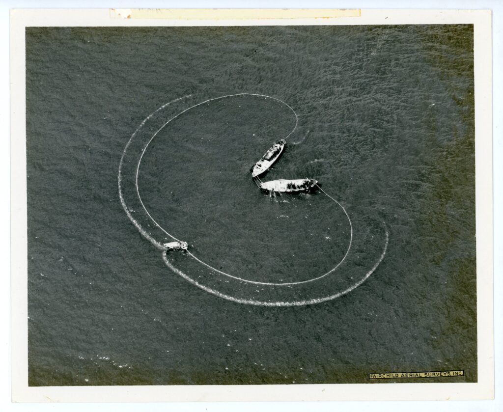
“Fish Nets, Rockaway, Long Island” June 12, 1937. 2018.008.0249
Seine fishing is a controversial method of fishing and it involves using a large fishing net, called a seine, cast off the side of large commercial fishing boats to encircle massive schools of the fish to collect tons of them for oil and protein meal.
Atlantic Menhaden have fallen victim to overfishing in the waters of the Rockaways, and their harvesting was banned by the New York State in 2019, unless the state declares a specific fish-kill emergency.
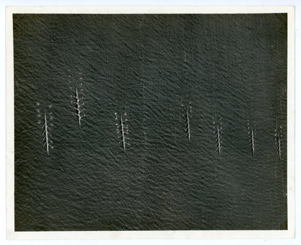
Can you guess what this image depicts?
These “scratches” in the water are rowing boats in 1937, participating in the almost annual June Intercollegiate Rowing Association (I.R.A) regatta in Poughkeepsie, New York.
The event was held on the Hudson River at Poughkeepsie from 1895 to through 1949, and it has its origins in the history of America’s oldest collegiate sports.
Regatta began in 1852 with the first competition between Harvard and Yale. The Harvard/Yale race was held annually, mostly in the Thames River in New London, Connecticut, and still is to this day.
“Regatta at Poughkeepsie, New York” June 22, 1937. 2018.008.0278
By the 1880s, other schools had organized their own rowing teams plus a governing body, the I.R.A., but unable to forge an agreement with Harvard and Yale they decided to hold their own at an alternate venue. Teams came from all over the east, the Midwest and eventually the far west to compete.
This 1948 aerial view shows in its center a Day Line steamboat off Peekskill, where the Hudson River turns around Jones Point.
The Hudson River Day Line was the leading excursion steamboat line along the river, from New York City to Albany, from the 1860s through the 1940s. These elegant and speedy steamers were widely known and popular with the traveling public, many of which took the Day Line boats to the Catskill Mountains region for summer vacations, or took the boats for day trips in the riverside parks like Bear Mountain State Park and Kingston Point Park.
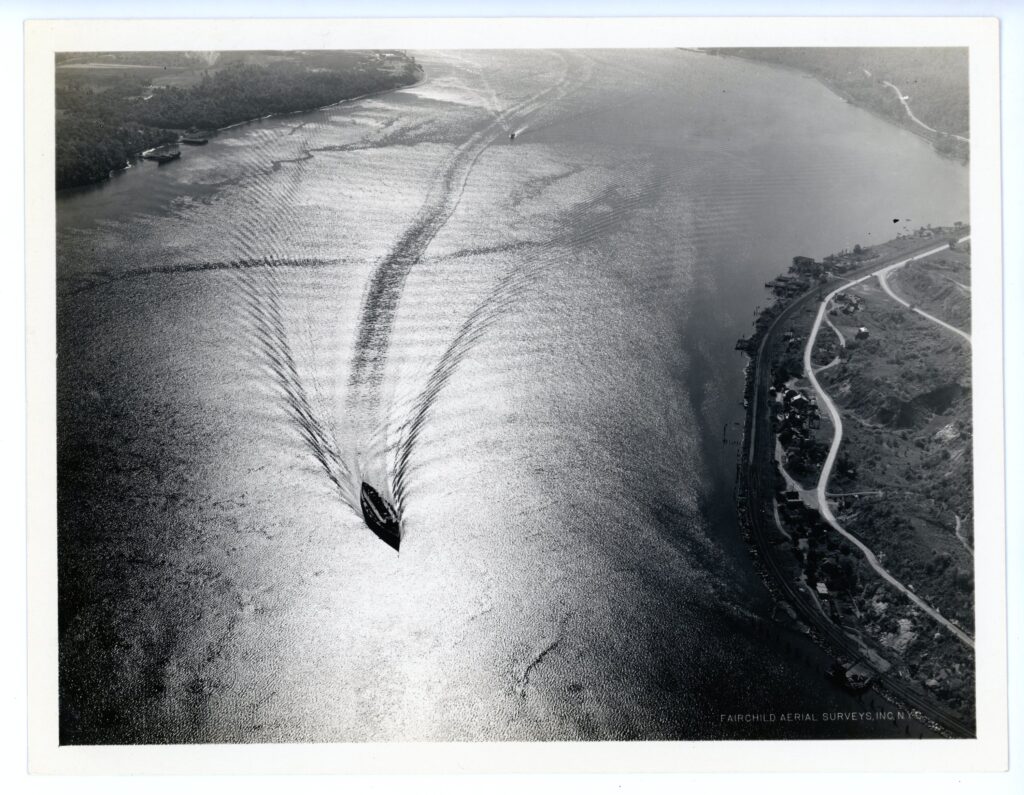
“Day Line steamboat off Peekskill, New York” October 15, 1933. 2018.008.0183
When this photograph was taken the fortune of the company was already in decline, and the original owners, the Van Santvoords and the Olcotts, sold the company that same year. With a postwar return to prosperity, and a huge increase in the production of passenger cars, travel by steamboat seemed old-fashioned to many.
Suggested readings and resources
“The visual rhetoric of the aerial view: From surveillance to resistance” by Eli B. Mangold and Charles Goehring. Published by Quarterly Journal of Speech, Volume 105, 2019, Issue 1, pp. 25-41.
The Metropolitan Museum of Art, Timeline of Art History, “The Daguerreian Era and Early American Photography on Paper, 1839–60” October 2014.
“Photography Changes Everything” edited by Marvin Heiferman. Aperture Foundation and Smithsonian Institution, 2012.
“From God’s-eye to Camera-eye: Aerial Photography’s Post-humanist and Neo-humanist Visions of the World” by Paula Amad. Published in the journal “History of Photography” Volume 36, 2012, Issue 1, pp. 66-86.
Smithsonian National Air and Space Museum’s Online Exhibition “Looking at Earth”
Other institutions with Fairchild Aerial Surveys, Inc. photographs:
- Smithsonian National Air and Space Museum
- New York Public Library Digital Collections
- New York State Archives Digital Collection
- Hoboken Historical Museum Online Collection
- US Santa Barbara Library
Research Policies
Conducting research is a vital part of the Seaport Museum’s work. The Museum is actively engaged in a complete inventory of its collections and archives. This ongoing project will improve future public access to the materials in our care and ensure that items are documented and preserved for future generations.
References
| ↑1 | According to Paula Amad’s overview of the history of aerial photography “From God’s-eye to Camera-eye: Aerial Photography’s Post-humanist and Neo-humanist Visions of the World” , published in 2012 the journal History of Photography, Volume 36, 2012, Issue 1, pp. 66-86. |
|---|---|
| ↑2 | “Photography Changes How War are Fought” by Von Hardesty. Published in “Photography Changes Everything”, Aperture Foundation and Smithsonian Institution, 2012, pp. 195-197. |
| ↑3 | “Photography Changes the Course of International Events” by Sandra S. Phillips. Published in “Photography Changes Everything”, Aperture Foundation and Smithsonian Institution, 2012, pp. 90-92. |
| ↑4 | THE STORY OF FAIRCHILD AERIAL SURVEYS, INC. by Leon T. Eliel, published on PHOTOGRAMMETRIC ENGINEERING JOURNAL, September 1942, pp. 163-170. |
| ↑5 | “Manhattan’s Luxury Liner Row” by William H. Miller, published on Power Ships, Spring 2020, pp. 10-15. |
